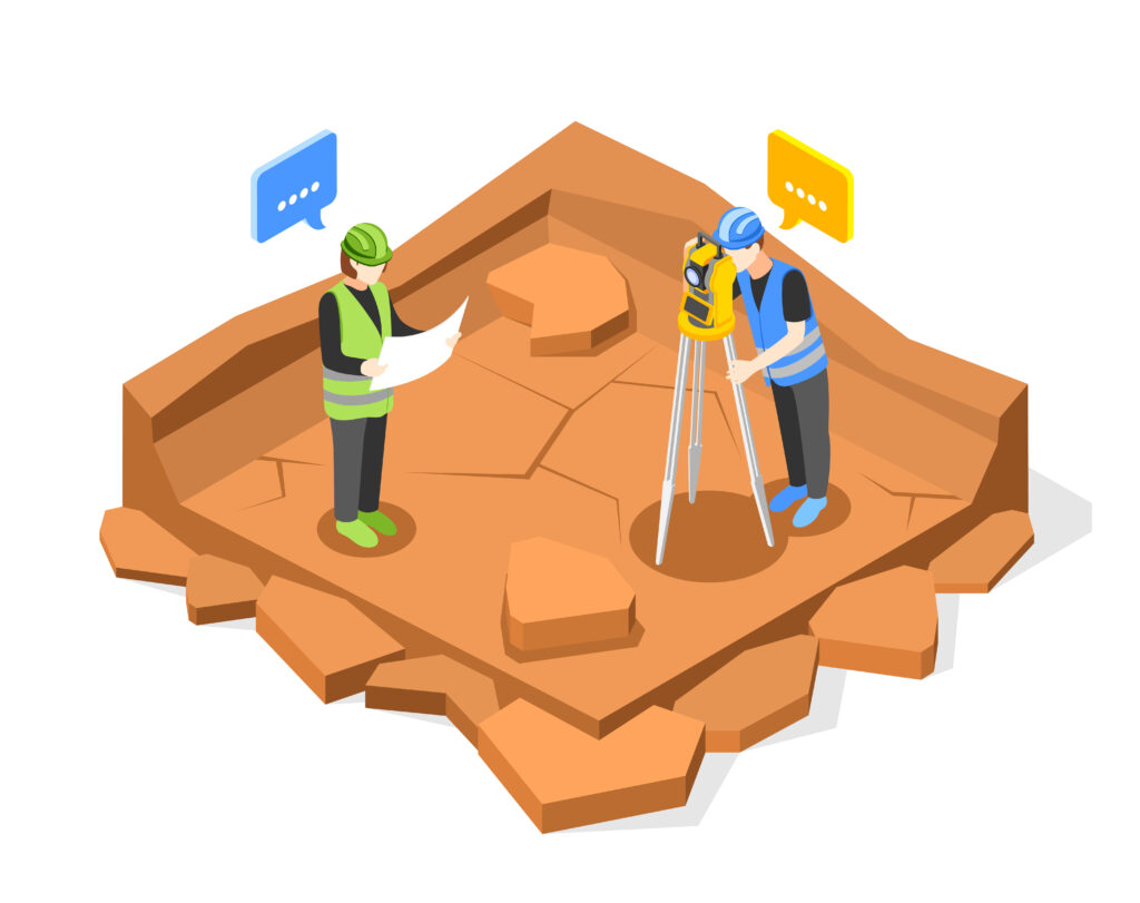
Boundary Survey
Boundary survey services involve the precise determination and mapping of property lines and boundaries. Surveyors use specialized instruments and techniques to identify and mark the corners and limits of a parcel of land. This type of survey is essential for property transactions, construction projects, and legal purposes, providing accurate information about the dimensions and location of land boundaries. Boundary survey services help prevent disputes between neighboring landowners by clearly defining property lines and ensuring that structures are situated within the correct boundaries.

Topographic Survey
Topographic survey services involve the detailed mapping and representation of the natural and man-made features of a specific area. Surveyors use specialized equipment to measure and record the elevation, contours, and other relevant characteristics of the land. This type of survey is essential for various purposes, including urban planning, engineering design, and environmental assessments. Topographic surveys provide a comprehensive understanding of the terrain, enabling accurate decision-making in land development projects. The resulting maps depict the physical features of the landscape, such as hills, valleys, rivers, and structures, facilitating informed planning and design processes.
Setting out survey
Setting out survey services involve the precise establishment of reference points and markers on a construction site based on engineering or architectural plans. Surveyors use specialized instruments to translate the design specifications onto the actual ground, ensuring that structures are placed accurately according to the intended layout and dimensions. This process is crucial in construction projects to prevent errors and ensure that buildings align with the approved plans. Setting out survey services contribute to the overall accuracy and success of the construction by providing a reliable foundation for builders to follow during the construction process.

Control network establishment
Control network establishment services involve the creation of a network of precisely measured and documented control points on the ground. These control points serve as reference markers with known coordinates, providing a stable foundation for accurate positioning and orientation in various surveying and construction activities. Surveyors use specialized instruments to measure and establish these control points, ensuring consistency and reliability in spatial measurements across a given area. The establishment of a control network is fundamental for maintaining accuracy in subsequent surveys, mapping, and construction projects. It serves as a reliable reference framework for spatial data collection and analysis.
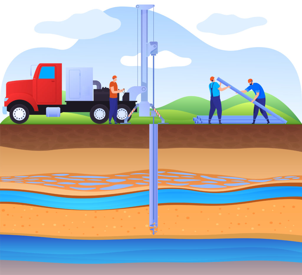
Underground water detection
Underground water detection services involve the use of specialized techniques and equipment to identify and locate groundwater resources beneath the Earth’s surface. These surveys utilize technologies such as ground-penetrating radar, electromagnetic methods, or seismic surveys to assess subsurface conditions and detect the presence and characteristics of underground water sources. The information obtained from these surveys is valuable for various purposes, including groundwater exploration, well site selection, and water resource management. Detection services play a crucial role in understanding subsurface water availability and aiding in informed decision-making for water-related projects and resource planning.
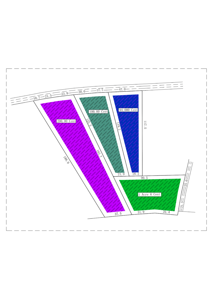
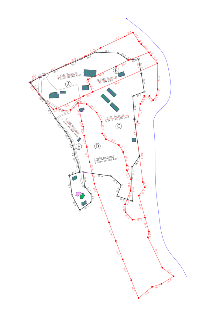
Subdivision Survey
Subdivision survey services involve the process of dividing a large tract of land into smaller lots or parcels. Surveyors use specialized tools and techniques to establish the boundaries, dimensions, and legal descriptions of each subdivided parcel. This type of survey is essential for property development, real estate transactions, and compliance with zoning regulations. Subdivision surveys help ensure that each subdivided lot meets local planning and land use requirements. The resulting survey maps provide a clear representation of the layout and dimensions of the subdivided land, facilitating proper development and documentation for legal purposes.
Master planning support survey
Master planning support survey services involve providing surveying assistance to support the development of master plans for urban or large-scale projects. These surveys play a crucial role in collecting essential data such as land characteristics, topography, and existing infrastructure. Surveyors use specialized techniques to assess the site, contributing valuable information for the creation of comprehensive master plans that consider spatial relationships, zoning, and future development. These survey services help in the planning and design process, facilitating well-informed decision-making during the master planning phase of a project.


Construction Surveying
Construction surveying services involve the application of surveying techniques and tools to facilitate the construction process. Surveyors use specialized instruments like total stations, GPS receivers, and laser levels to precisely measure and map the physical features of a construction site. This includes establishing control points, determining property boundaries, and ensuring accurate placement of structures according to architectural and engineering plans. Construction surveying plays a crucial role in maintaining accuracy, adherence to design specifications, and preventing errors during the construction of buildings, infrastructure, and other projects. It contributes to the overall success and quality of the construction process by providing essential data for layout, grading, and vertical positioning.
Document verification survey
Document verification survey services involve a comprehensive examination and validation of various documents to ensure accuracy, authenticity, and compliance with relevant standards or requirements. This type of survey is conducted in various fields, including legal, financial, or regulatory contexts, to confirm the legitimacy of paperwork, contracts, or certificates. Specialized surveyors utilize established protocols and expertise to assess the consistency and reliability of provided documentation. The goal is to contribute to informed decision-making, regulatory compliance, and risk mitigation in diverse industries where accurate and trustworthy documentation is crucial.